
With a diverse resource endowment, proven capability to bring a resource to market and a responsible operating environment, Queensland is an attractive investment jurisdiction.
Click to enlarge the map and view critical mineral resources and project locations (PDF, 954KB) across Queensland.Support for critical mineral exploration in Queensland
Location of critical minerals
The global demand for critical minerals is rapidly increasing given their key role in the development of modern technology. Queensland is recognised globally as a leading destination for mining and resources investment, and as Australia's gateway to Asian markets. This puts our state in a great position to discover critical minerals that are used to make everyday items such as:
- smartphones
- wind turbines
- electric cars
- solar panels
- batteries.
Although critical minerals are found across Queensland, they are concentrated in the state's North West and North East Minerals Provinces—from Mount Isa in the west to Townsville in the east, a distance of nearly 1,000km. Some critical minerals are found with other traditionally mined resources, such as cobalt with copper, while others are the dominant mineral in a deposit. Find out more about Queensland's North West Minerals Province.
Learn more about mining and resources maps and spatial data.
The Geological Survey of Queensland (GSQ) is expanding our shared knowledge of Queensland's geology and resource potential. This information assists the industry in sustainably accessing Queensland's minerals and energy resources.
Projects in Queensland
Mining critical minerals
Some critical minerals—such as copper, zinc and aluminium—have been mined in Queensland for decades but are being used in new and different applications to help emerging technologies and contribute to decarbonisation. However, quite a few minerals are about to be mined for the first time. That's why the exploration of critical minerals is crucial to help unearth new and deeper reserves and deposits.
We know there are deposits of critical minerals in a broad corridor from Mount Isa to Townsville and we are currently exploring these areas through numerous initiatives. Many critical minerals are located alongside traditional commodities, so we are focusing on the following 2 areas to locate and utilise these minerals:
- new exploration activities
- re-examining existing mines and reprocessing mine waste.
Exploration activities, such as geophysical surveys, help us discover new deposits of minerals. The following projects involve searching for minerals as well as looking at ways in which we can sustainably extract them.
Kamilaroi airborne magnetic survey
GSQ is undertaking an airborne magnetic survey north of Mount Isa, following the known trend of cobalt mineralisation associated with major copper deposits. This survey will better define key structures known to be responsible for this style of mineralisation. The survey has the potential to open exploration for copper and cobalt in previously under-explored areas.
What is it?
An airborne magnetic survey is where either an aeroplane or helicopter with a magnetometer attached covers a geological map over large areas—it's one of the most rapid and efficient methods of carrying out magnetic surveys. The magnetometer measures the total intensity of the Earth's magnetic field along continuous flight lines with fixed spacing. The aircraft is flown at a constant terrain clearance, with modern surveys flown at less than 100 metres above ground level.
Canobie gravity gradiometry survey
GSQ will undertake a high-resolution gravity gradiometry survey north of Cloncurry, including the Saxby area, to assist with targeting critical mineral and iron oxide copper-gold (IOCG) deposits . In addition to being a major source of copper in the North West, IOCG deposits are a key host to other critical minerals such as cobalt and rare earth elements.
What is it?
Gravity gradiometry is the study and measurement of variations in the Earth's gravity field. For mineral exploration, it measures the density of the subsurface to gain information on geological structures underground and undersea. It helps us understand and see beneath large expanses of covered rocks and reveal our potential resource deposits. Gravity gradiometry enables us to efficiently target exploratory activities and minimises surface and community disturbance.
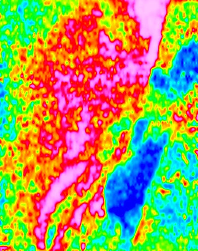
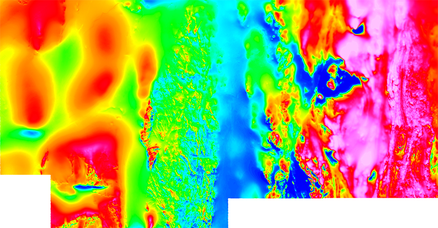
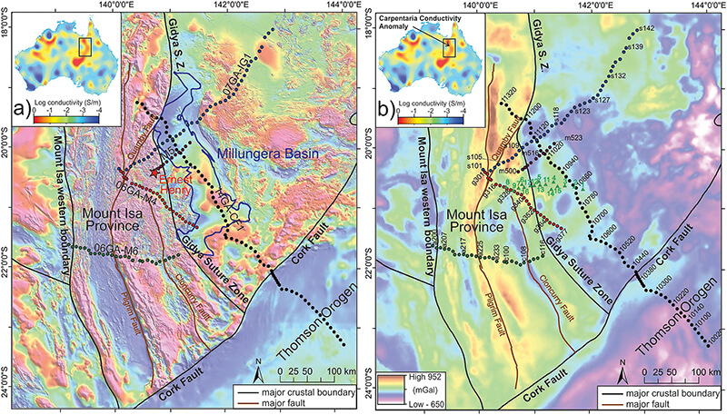
Carpentaria Conductivity Anomaly magnetotelluric survey
GSQ is undertaking 2 broad-scale magnetotelluric (MT) surveys to the south and east of Cloncurry to map out the Carpentaria Conductivity Anomaly, a geological feature that may be prospective for copper, cobalt and rare earth elements.
What is it?
Magnetotelluric surveys are used to reconstruct the underground resistivity disruption from shallow depths to depths of up to hundreds of kilometres. It uses natural time variations of the Earth's magnetic and electric fields to measure the subsurface. Electrical resistivity of rocks and minerals is an important physical property to measure to understand geological structures and processes.
Extracting rare earth elements sustainably
This initiative is crucial to the future development of an entire rare earth elements (REE) supply chain. By demonstrating an economic and environmentally sustainable extraction method for REE, numerous exploration-stage REE projects will become viable.
Commercialising these techniques will create new jobs in and around a Queensland-based processing facility, with flow-on benefits for communities and the region.
Determining the rare earth element potential of Queensland's basins
Researchers at Adelaide University have developed a cutting-edge model for rare earth mineralisation in basin environments. GSQ will conduct a project in collaboration with Adelaide University to develop this model further with particular reference to specific examples and regions in North West Queensland, such as the Georgina Basin around Mount Isa. This model will enable explorers to identify prospective target areas more effectively.
Collaborative Exploration Initiative
The Collaborative Exploration Initiative (CEI) supports innovative mineral exploration by providing grants to companies undertaking higher-risk exploration activities, or activities in previously under-explored areas of Queensland.
We are always looking at ways to sustainably re-use old mines. In our search for critical minerals, we are analysing waste from existing mines, and looking at old mines to see if they contain viable deposits.
Analysing mine waste materials and core samples
In collaboration with the Sustainable Minerals Institute at the University of Queensland, the GSQ is re-analysing samples from mine waste materials at mine sites throughout Queensland to identify critical mineral opportunities.
In the past, cost constraints prevented many companies from analysing drill core samples beyond a restricted suite of metals when conducting their exploration programs. For example, a copper explorer might typically examine the core only for copper, lead, zinc and possibly gold and silver. Cobalt—which may be associated with copper—was not commonly included in those examinations.
GSQ is re-analysing large volumes of core samples obtained from known deposits. GSQ has access to many drill core and surface samples through its drill core libraries, as well as through collaborative relationships with key Queensland explorers. This information will be digitised and released to the public.
Reusing old mines
Several previously mined sites in Queensland have returned to state control and may contain untapped opportunities. These sites are ideal for exploration as they are on existing mining leases, infrastructure (in some cases) already exists, and the resources are above ground. In collaboration with the University of Queensland, we are examining the potential of mine waste for critical minerals and finding opportunities for further development.
What is it?
Mine waste comes from extracting and processing mineral resources. It can include things like:
- tailings–the waste material left over after the valuable component has been removed through processing
- stockpiles–piles or storage locations for materials or product which has been extracted through the mining process
- waste dumps–usually the most visually obvious landforms left after open pit mining. The dump's height and slope angles need to be designed to ensure the final landform is safe, stable, and not prone to erosion.
Some of this waste is unlikely to damage the environment; however, some waste can contain large quantities of substances like heavy metals. Properly managing mining waste will prevent or minimise water and soil pollution arising from acid or alkaline drainage and the leaching of heavy metals.
If critical minerals are found, sites could be re-packaged and offered back to the market, perhaps with incentives or collaborative arrangements to address any legacy environmental issues.
Learn more about mine waste and the re-commercialisation of abandoned mines.
Follow the success story of the Mount Carbine historic mine waste expansion project where the transformation of an old mine site produced critical minerals.
More information
For more information about exploration activities or geological surveys, email gsq@resources.qld.gov.au.
Support for critical mineral exploration in Queensland
An immediate priority for delivering the Queensland Critical Minerals Strategy is encouraging more exploration to support new mineral discoveries. To help encourage more exploration, zero rent arrangements apply to exploration permits for minerals from 1 September 2023 until 31 August 2028. Visit zero rent for EPM for more details.
Funding is available to advance innovative exploration in mineral prospects and to support future development, including tenders, grants and other resource investment opportunities.
Find out about the exploration incentives and opportunities available in Queensland.
To develop critical mineral projects, the government is investing in exploration activities to improve scientific understanding and supply the valuable geoscience data needed by industry to help locate and define deposits for future production.
Where to from here
Support is available at each step of your exploration activity, beginning with access to georesource products and progressing to applying for the relevant resource authorities and environmental approvals for exploration activities.
Undertake desktop geological studies using Queensland's geological and resource information services. Start by walking through our online georesources product offerings with the geoscience information and data story tool.
GSQ makes Queensland's mineral geoscience data and information available through its publications, maps and digital data products. Additionally, the Exploration Data Centre (EDC) in Brisbane and the John Campbell Miles Drill Core Storage Facility in Mount Isa house geoscience data and information dating back to the mid-1800s. The collections include drill core and cuttings from current and past exploration programs and samples from GSQ mapping fieldwork.
Online access is available for many of our products, through:
Geoscience Australia provides an extensive catalogue of data, publications, online tools, maps and videos. Conduct a data and publications search or visit Geoscience Australia to learn more about Earth sciences for Australia's future.
Contact Geoscience Australia with any enquiries.
Queensland's mineral and energy resources are managed by the Queensland Government on behalf of all Queenslanders. Before you can explore for resources in Queensland, you must obtain the appropriate resource authority. You can apply for an authority to explore for minerals by making a direct application or through a tender process.
Find out more about the Queensland exploration program and the competitive tendering for exploration.
Whether making a direct application or submitting a response to a competitive tender, you will need to meet environmental and other approval requirements (e.g. native title) before the resource authority is granted.
Understand what type of approvals and decisions are needed for the type of exploration activity including:
- a resource authority that permits the activity to prove up potential resources
- an environmental authority to authorise the activity
- an estimated rehabilitation cost decision to estimate the costs of
- rehabilitating the land on which the resource activity is carried out
- and
- preventing or minimising environmental harm, or rehabilitating or restoring the environment, in relation to the resource activity
- payment of the required scheme contribution or amount of surety as decided by the Scheme Manager.
Exploration permit for minerals
An exploration permit allows you to prospect, conduct geophysical surveys, drill, and sample and test materials to determine the quantity and quality of minerals present.
Learn more about an exploration permit for minerals.
Environmental approvals for exploration activity
Activities that meet the definition of small scale mining activity (PDF, 71KB) won't require an environmental authority.
Read guidance for small scale mining projects from the Department of Environment, Science and Innovation.
If the activity does not meet the definition of small scale mining, you will need an environmental authority.
Learn more about applying for an environmental authority for a resource activity, including the eligibility criteria and standard conditions for exploration activity and mineral development projects (PDF, 780KB).
Learn more about financial assurance for resource activities.
If you already hold an exploration permit and there is a significant mineral occurrence of possible economic potential, you can apply for a mineral development licence (MDL) to allow you to evaluate the development potential of the defined resource. The MDL allows you to conduct geoscientific programs (e.g. drilling, seismic surveys), mining feasibility studies, metallurgical testing and marketing, and environmental, groundwater, engineering and design studies.
As the holder of an MDL, you will need to make good any damage you cause to surrounding water bores and that may require you to have a water monitoring authority.
If you decide to change the level and type of activity to be conducted under the MDL, you will need to confirm that you do not require a new or different environmental authority to operate.
Learn more about applying for an environmental authority for a resource activity, including the eligibility criteria and standard conditions for exploration activity and mineral development projects (PDF, 780KB).
Learn more about financial assurance for resource activities.
Enquiries
- Last reviewed: 30 Aug 2023
- Last updated: 7 Nov 2023